Printify
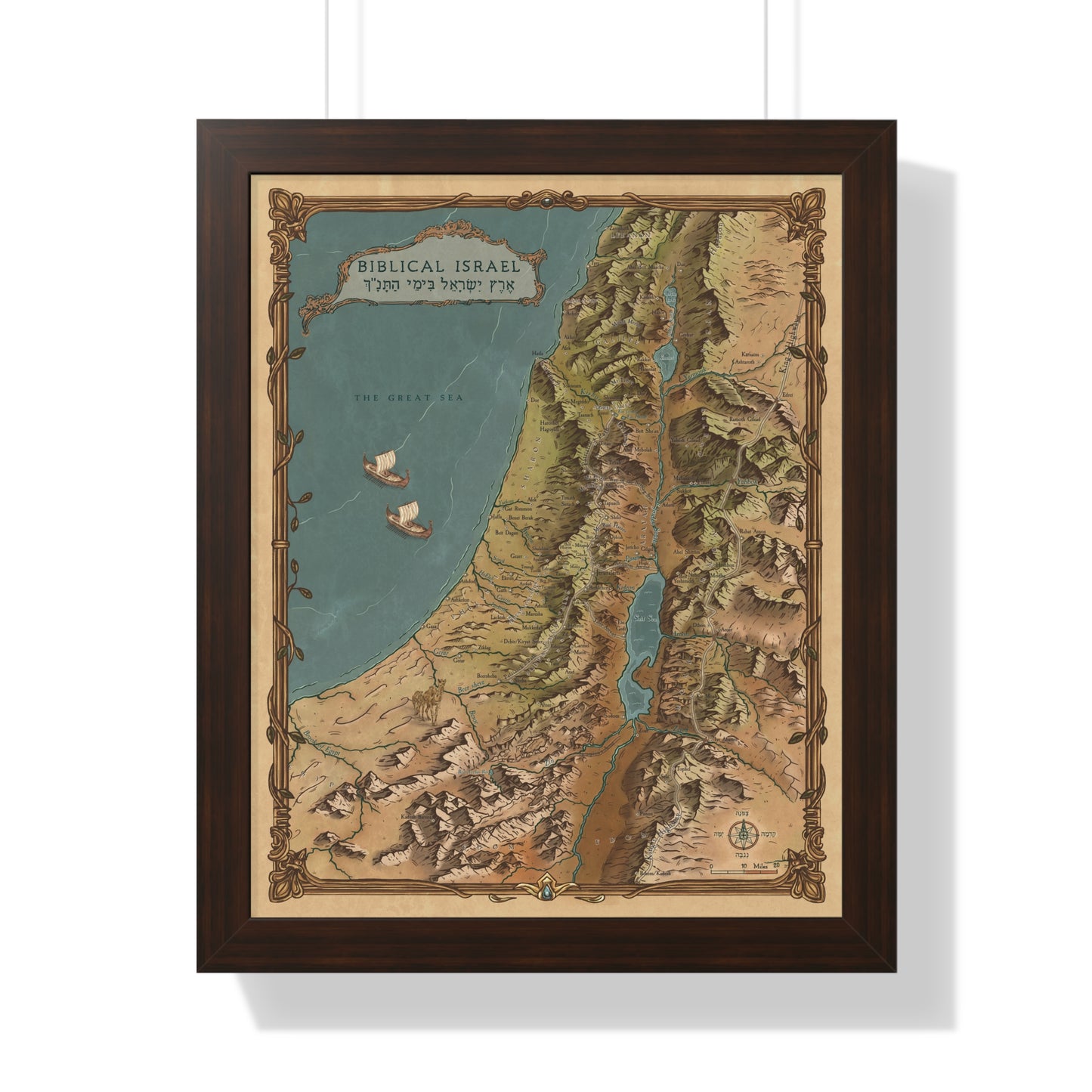
Biblical Israel Map - Framed in Walnut
Biblical Israel Map - Framed in Walnut
Printed in the USA · Free US shipping · Arrives ready to hang · 30-day guarantee
I am a licensed Israel tour guide. Since 2011 I have walked the land of the Bible with thousands of travelers, and for years I wished for one map that shows the Bible's geography the way the land actually looks. So I made it. I put thousands of hours of research into this map, and a professional cartographer drew every ridge, valley, and coastline by hand. It is the same map you see in my Walking Tanach videos. This version arrives framed, with the hanging hardware already attached. Open the box, hang it, done.
What the map shows
- Hundreds of Biblical cities, each placed according to current research
- Ancient roads and trade routes
- Springs, rivers, mountains, and valleys in clear hand-drawn topography
- The regions of the land as the Bible names them
When you can see that Bethlehem sits within sight of Jerusalem, or how far Joseph walked to find his brothers at Dothan, the stories change. The geography is part of the story. This map puts it on your wall.
Made to be displayed
I made this map beautiful on purpose. Framed in walnut, it reads as art from across the room and as a reference work up close, in your home, your office, or your classroom.
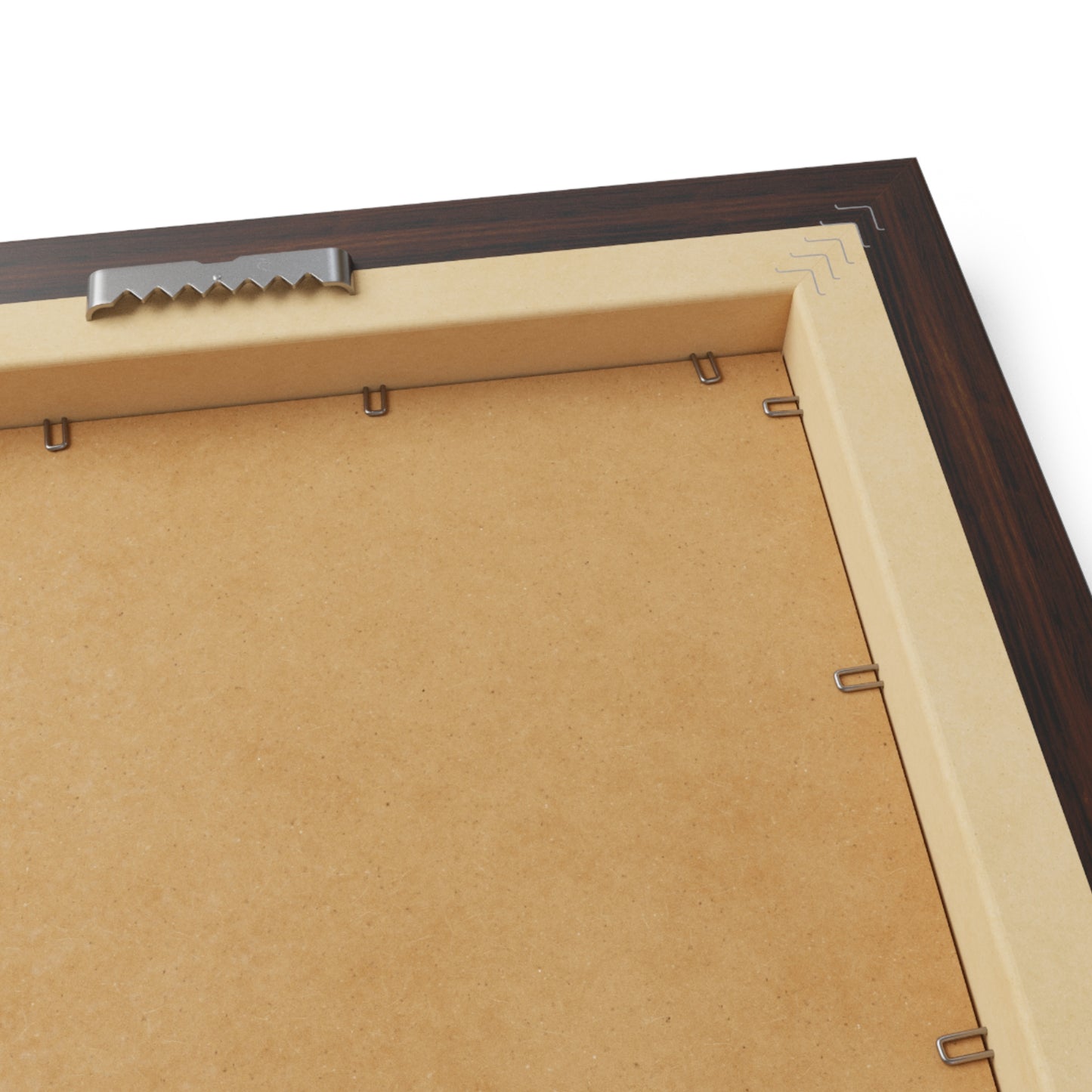
Frame and materials
- Walnut finish frame, durable and resistant to warping
- Protective acrylic cover
- LexJet Premium 200 gsm archival paper with a matte finish
- Hanging hardware pre-installed
- Framed in the USA
Prefer to choose your own frame, or want the largest size? The unframed archival print comes in 18" x 24" and 22" x 30".
Questions? Email service@biblemap.shop. I answer personally.
Couldn't load pickup availability
Share